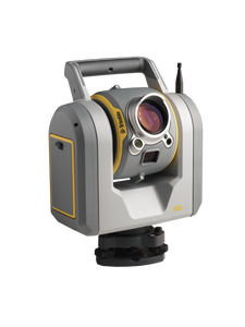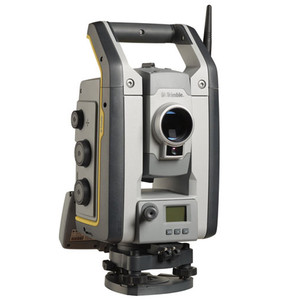
Trimble SX12 3D Scanning Robotic Total Station
Please Call for a Quote and to Setup a Free Demo at (724) 266-1600 or PLI@Laserinst.com
![]()
Trimble SX10 Robotic Total Station: Datasheet
3D Scanners Comparison | Total Station Comparison
Regulatory Information | Applications Overview | Quick Start Guide | User Guide
With the NEW Trimble SX12 3D Scanning Total Station, working harder has never been easier. It combines innovative technology with simple and intuitive functionality to help you save time, maximize efficiency and get more done in the field. The SX12 is the one instrument you need to handle any surveying project by integrating surveying, imaging and 3D scanning capabilities into your everyday workflow.
Features
- Combines surveying, imaging and high speed 3D scanning in one revolutionary solution.
- 1" Angular accuracy
- 1.5mm Scan range noise at 200m
- 14mm Diameter EDM laser spot at 100m
- Quick data capture, even at long range
- 26.6 kHz scan measurement rate, up to 600m
- 1.6" Total station measuring time in prism mode
- 1.2" Total station measuring time in DR mode
- Vivid, eye-safe laser pointer
- Green and focusable, this laser pointer is exceptionally small, bright and still eye-safe
- 3mm Diameter laser pointer spot at 50m
- Simple navigation and documentation with Trimble VISION™ camera system
- Three integrated and calibrated cameras in the telescope
Applications | Overview (Click Here!)
- Topographic Survey/General Surveys (Boundary/Land Title Surveys)
- Roadway/Corridor Surveys (Roadway design and Topo)
- Volumetric Surveys (Stockpile volumes)
- Infrastructure Surveys (Civil Infrastructure As-Builts)
- Building As-Built and Design Surveys
- Utility Design Survey
- Power Line Inspection/Clearance
- Forensics/Crash Scene Investigation
- Mine/Quarry Survey
- Tank Calibration/Inspection
- Dimensional Control
Software
Trimble Business Center lets you fully integrate Trimble SX12 data into your projects using the familiar workflows of the marketing leading survey office software. Enhanced point cloud management, automated extraction and interoperability to leading CAD and GIS packages ensures that you can satisfy even your toughest client demands.
The Trimble Tablet Rugged PC operates the feature rich, intuitive Trimble Access field software. Streamlined workflows guide crews through common project types, helping to get the job done faster with less distractions. Trimble Access workflows can also be customized to fit your needs.
Back in the office, trust Trimble Business Center software to help you check, process and adjust your optical, leveling, and GNSS data in one software solution. No matter what Trimble instruments you use in the field, you can trust that Trimble Business Center office software will help you generate industry-leading deliverables.


