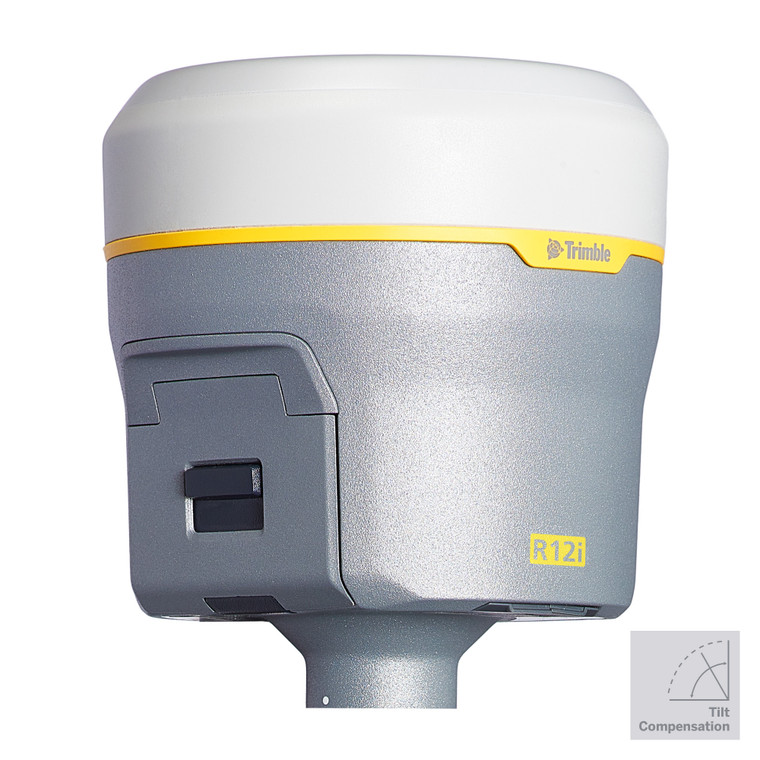
Trimble R12i GNSS System
TrimblePlease Call for a Quote and to Setup a Free Demo at (724) 266-1600 or PLI@Laserinst.com

Trimble R12i GNSS System: Datasheet
The R12i delivers unmatched GNSS performance, speed and accuracy to boost your productivity like never before. With improved performance in challenging GNSS conditions and robust IMU-based tilt compensation that lets you forget about leveling the pole, you'll get more done faster than you thought possible.
KEY FEATURES
- Trimble® Inertial Platform™ (TIP) Technology; Calibration-free and magnetically immune IMU-based tilt compensation for topo measurements and stakeout
- Trimble ProPoint™ GNSS positioning engine; engineered for improved accuracy and productivity in challenging GNSS conditions
- 672-Channel solution with Trimble 360 satellite tracking technology
- CenterPoint® RTX correction service for fast RTK level accuracy worldwide via satellite/IP
- Trimble xFill® correction outage technology
- Optimized for Trimble Access™ field software
- Android™ and iOS platform support
- Cellular, Bluetooth®, Wi-Fi data connectivity
- Military-spec rugged design and IP67 rating
- Ergonomic form factor
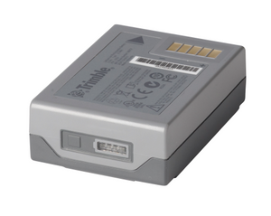
- All day battery with built-in status indicator
- 6GB internal memory
- Supports augmented reality capabilities through Trimble SiteVision™
Trimble ProPoint™ GNSS Technology
Improved performance in challenging GNSS conditions*, with groundbreaking signal management that leverages the latest developments in GNSS signal infrastructure and Trimble receiver hardware
Trimble SurePoint™ Technology
Fully compensates for pole tilt. Conveniently measure points that would otherwise be inaccessible with complete quality assurance.
Trimble CenterPoint® RTX Corrections Technology
Delivers GNSS corrections via satellite or internet connection with unrivaled speed and accuracy for a PPP solution.
Trimble 360 Technology
Powerful 672-channel solution with Trimble 360 technology delivers the most advanced satellite tracking of all constellations, and provides improved protection from interference and spoofed signals.
Trimble xFill® Technology
Reduces downtime in the field, with continuous RTK coverage during correction outages from an RTK base station or VRS network.
Specifications
- 8 mm horiz. /15 mm vert. real time kinematic precision
- 672 GNSS channels
- Compact: 11.9 cm x 13.6 cm
- GPS/GLONASS/Galileo/BeiDou/NavIC/QZSS/SBAS constellation support
- Wide band UHF radio up to 2 Watt Tx
- 6 GB internal memory
- Lightweight: 1.12 kg
- Bluetooth, Wi-Fi, Cellular wireless communications
For available financing options or if you would like to discuss how the R12 could help your business, contact your local PLI office today!
-

R12i Tutorial: Measure at Extreme Angles
In this video we show you how the R12i can measure points with...
-

R12i Tutorial: Data Traceability
The R12i GNSS System provides surveyors data traceability for ...
-

R12i Tutorial: System Overview
This video provides a short overview of the Trimble R12i GNSS ...
-

R12i Tutorial: Stakeout Points with Tilt Compensation
In this video we show you how to stakeout points with the Trim...
-

Trimble R12i: Speed Test with TIP Technology
In this video, we demonstrate how much faster the R12i is with...
-

R12i Tutorial: Turning On and Off Tilt Compensation
With the Trimble R12i, you'll want to keep tilt compensation o...
-

R12i Tutorial: Starting a Survey
This video shows you how to start surveying in Trimble Access ...
-

Trimble R12i: Survey Field Test
David Wilson is a professional land surveyor in the United Sta...


