Trimble MX60 Mobile Mapping System
TrimblePlease Call for a Quote and to Setup a Free Demo at (724) 266-1600 or PLI@Laserinst.com
Spec Sheet | Application Overview
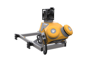
The Trimble® MX60 is the latest addition to the Trimble mobile mapping portfolio, boasting significant advancements over existing models. Designed to meet the diverse needs of surveying and asset management professionals, the MX60 offers improved positioning and optics, making it an ideal tool for transportation infrastructure and road analysis work and comprehensive asset management for utilities, including fiber to the home.
Key Features
- Laser Effective Measurement Rate Up to 2000kHz
- Spherical Camera Up to 72MP
- Embedded Trimble GNSS-Inertial System (Trimble InFusion+ with ProPoint Engine)
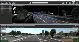
- Practical Mobile Mapping System combining precise LiDAR data and immersive panoramic imagery
- State-of-the-art Trimble LiDAR technology integrated with a proven and reliable mobile platform
- Accurate point clouds for applications such as road surfaces, highway maintenance or asset management
- Simple system installation with intuitive, browser-based operation
- Complete field-to-finish workflows, provided by Trimble, capture, process, extract and share
Applications
Whether you're a first-time mobile mapping user looking for a step change in productivity or an experienced mobile mapping professional considering adding additional capacity to your fleet, the Trimble MX60 will generate reliable deliverables for a range of applications.
- Highway Assets
- Utility Assets
- City Assets
- Ground Models
- Engineering Profiles and Cross-Sections
- Road Surfaces


