Trimble Inpho Photogrammetry Software
TrimblePlease Call for a Quote and to Setup a Free Demo at (724) 266-1600 or PLI@Laserinst.com
Trimble Inpho Photogrammetry Software
Tech Sheets | Release Notes | Training Courses
Case Study | Customer Story | YouTube Playlist
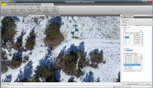
Trimble Inpho software is designed to precisely transform aerial images into consistent and accurate point clouds and surface models, orthophoto mosaics and digitized 3D features using state-of-the-art photogrammetry and remote sensing techniques.
The modules can be used as a complete system or individual components which integrate easily into any photogrammetric production workflow using 3rd party products. The portfolio also includes point-cloud and terrain modeling for massive data as well as airborne LiDAR scanning processing completed by automated city-modeling software.
Inpho is compatible with state-of-the-art photogrammetric camera systems.
Key Features:
- Geo-Referencing: Market-leading automatic aerial triangulation including complete camera calibration, robust bundle-adjustment and thorough quality assessment for image blocks of any size, overlap or geometry.
- Geo-Imaging: Available modules include OrthoMaster (professional software for high-quality ortho-rectification), OrthoVista (creatioin of orthomosaics) and MATCH-3DX (true orthophoto capability)
- Geo-Capturing: Available modules include MATCH-3DX (reach a new level in precision generating large-scale, dense point clouds), MATCH-T DSM (automatically create digital twin terrain and surface models) and Summit Evolution (collect 3D features directly into ArcGIS, AutoCAD, Global Mapper or MicroStation)
- Geo-Modeling: Available Modules include DTMaster (powerful point cloud and LiDAR data editing, refinging and CAD/GIS mapping) and SCOP++ (efficientl process hundreds of millions of DTM points)


