Spectra Geospatial Origin Survey Field Software
Spectra GeospatialPlease Call for a Quote and to Setup a Free Demo at (724) 266-1600 or PLI@Laserinst.com
Spectra Geospatial Origin Survey Field Software
Tech Sheet | Help Portal | Tutorial Videos
Downloads | Spectra Geospatial Site
Spectra Geospatial Origin is the new, modern software professional surveyors who use Spectra Geospatial's portfolio of solutions need to handle a full range of projects quickly and efficiently.
Intuitive and reliable, Origin offers an extensive range of features, including one-tap, easy-to-ouse featuring coding, powerful COGO computing, map layer manager and map-centric workflows for measuring and stakeout.
Key Features:
- Easy-to-use, modern field survey software
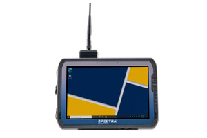
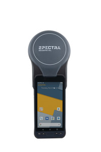
- Supports Spectra Geospatial Android and Windows Devices
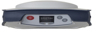
- Full support for a wide range of instruments including mechanical and robotic instruments, as well as GNSS receiers,
- Fully featured stakeout including points, lines, arcs and polylines
- Advanced measurement tools like measure codes for simple and fast topographic feature and attribute collection
- Cloud connectivity for data transfer and communication between the field and office
- Integrated Surveying technology to enable optical and GNSS workflows in the same job, even supporting simultaneous connections to the total station and GNSS receiver
- Modern map displays with support for DXF, LandXML, WMS, JPG and many more map files
- Intuitive COGO directly in the map utilizing data in the job or related map files


