Posted by Precision Laser & Instrument, Inc. on 24th Sep 2020
News
From Robotic Total Stations to Pipe Lasers, GNSS Receivers, Survey Stakes & More, Our E-Commerce Site is here to keep your projects moving!Shop Online Today! https://www.laserinst.com#PLI #Ge
…
Posted by Precision Laser & Instrument, Inc. on 22nd Sep 2020
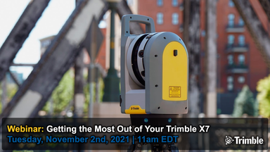
Webinar: "Trimble X7 3D Laser Scanner - Best Practices & Recommendations!"
Checkout this helpful webinar: "Trimble X7 3D Laser Scanner - Best Practices & Recommendations!" Watch: https://bit.ly/35WMDtZSchedule a Local Demo!https://www.laserinst.com/trimble-x7724-266-160
…
Posted by Precision Laser & Instrument, Inc. on 21st Sep 2020
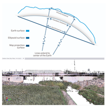
"Are Your Surveying & 3D Scan Data in Sync?"
"Are Your Surveying & 3D Scan Data in Sync?" Read On! https://bit.ly/32Pq3SnSchedule a Local Solutions Demo!724-266-1600 | PLI@laserinst.com#PLI #Geospatial #Trimble #TrimbleGeospatial #
…
Posted by Precision Laser & Instrument, Inc. on 18th Sep 2020
"Trimble R12i - What One Beta Tester Says About the New GNSS Receiver!"
"Trimble R12i - What One Beta Tester Says About the New GNSS Receiver!" Read On! https://bit.ly/2FPYxLaSchedule a Local Demo!https://www.laserinst.com/trimble-r12i-gnss-system724-266-1600 |
…
Posted by Precision Laser & Instrument, Inc. on 17th Sep 2020
Surveyor Says Podcast: Hear the NSPS Director's Thoughts on Furthering the Surveying Profession!
"In this inspiring #Surveyor Says podcast, hear why NSPS Director, Dick Kleinmann, shares his time helping guide NSPS members to further their career and knowledge of the surveying profession!"Podcast
…
Posted by Precision Laser & Instrument, Inc. on 16th Sep 2020
Featured E-Commerce Items: September 13th-19th, 2020
From Robotic Total Stations to Pipe Lasers, GNSS Receivers, Survey Stakes & More, Our E-Commerce Site is here to keep your projects moving!Shop Online Today! https://www.laserinst.com#PLI #Geospat
…


