Hydrolite-TM Echosounder Kit
Seafloor SystemsPlease Call for a Quote and to Setup a Free Demo at (724) 266-1600 or PLI@Laserinst.com

Seafloor Systems Hydrolite-TM Echosounder Kit Datasheet
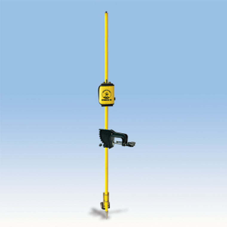
The HydroLite-TM should be included in every Survey and Engineering company’s standard equipment kit for hydrographic surveying. Developed to meet the requirements of the U.S. Army Tactical Dive Teams, the rugged, wireless HydroLite-TM looks and feels like your traditional survey instrument. It quickly measures and logs depths more accurately than standard systems, making fast work of ponds, rivers, lakes, and more. GPS and data collector sold separately.
Scope of Supply:
- SonarMite BT MILSpec echosounder kit
- Transducer, 200kHz, 9deg
- Internal rechargeable 12V battery
- HydroLite boat mount/pole kit
- Ping rate: 6 Hz
- Depth accuracy: 1cm/0.1percent of depth
- Output formats: NMEA, ASCII, Quality
- Operating range: 0.3m - 75m
- Rugged shipping case
- Quick Start Guide/User Manual
- 1-year support and warranty
Options:
- Coast Guard Beacon
- PC Data Acquisition
- Digital Bar Check
- Tide Gauge™
The HydroLite-TM has been featured in POB, Professional Surveyor, California Surveyor, IHS and Hydro International.
Specifications
| rechargeable 12v battery | |
| HydroLite Boat Mount/Pole Kit (P/N SEA9002) | |
| SonarMite MILSpec Echosounder Kit | |
| 200-KHz | |
| 4º | |
| 6-Hz | |
| 1cm / 0.1% of depth | |
| NMEA, ASCII, Quality | |
| 0.3m–75m | |
| serial, Bluetooth® | |
| Trimble, Leica, Topcon, Sokkia, Epoch, Ashtech, Magellan, Carlson |
FAQ
Q: What are the maximum and minimum operating depths of the HydoLite?
A: 1-1/2 feet to 250 feet
Q: Can I walk on land with the transducer held out over the top of the water?
A: Transducer must be fully submerged to get a zero depth out of the system.
Q: Is the SonarMite compatible with TVS Survey Pro Software?
A: No. Survey Pro does not currently support echosounder devices.
Q: What software is the SonarMite compatible with?
A: Trimble Survey Controller, Access, SCS900 and Terra Sync. Topcon (need to contact dealer for script), Carlson SurvCE, Leica 500, 1200 and Viva.
Q: Can I change the rate at which the SonarMite pings?
A: No, it only outputs twice a second, you can specify logging parameters within your logging software.
Q: Can the SonarMite output a NMEA string?
A: Yes as well as seven other echosounder format.
Q: What can I change internally on the SonarMite?
A: Output format and sound velocity.
Q: How do I calibrate sound velocity?
A: You can use either a standard bar check or a digital sound velocimeter.
Q : If the surface of the water is frozen, can I get a depth?
A: No, the transducer must be in water.
Q: Can the transducer ping through a metal hull, if there is water in the hull?
A: No, you will only get the depth of water that is inside your boat.
Q:Do I bring in sounding and GPS over the same COM port?
A: No, you cannot use the same port twice, at the same time.
Q: My Geo series datalogger just froze--what happened?
A: Either your internal GPS antenna lost view of the sky or your Bluetooth connection was lost.
Q: How do I know the SonarMite is working?
A: Red flashing light indicates SonarMite is on and pinging, blue light indicates active Bluetooth connection.
Q: How do I know if the transducer is pinging?
A: Red flashing light and series of faint ticking noises when transducer is next to ear.
Q: I’m connected to the echosounder but I’m getting all zeros out of the unit.
A: The transducer needs to be in water in order to get a depth value out of the echosounder
Q: When pairing the echosounder Bluetooth with my data collector, the system is asking for a pass code
A: The default pass code for the SonarMite echosounder is 1234. Older units have also used 1111 and 0000 values.
Q: I use Trimble Survey Controller on a TSC2 data collector, will the HydroLite work with this setup and is any other software required?
A: As long as you are using Survey Controller version 12.41 or later, no additional software is required.
Q: Can I use the HydroLite with my Trimble RTS Robotic Total Station?
A: Yes, (as seen in above photo) instead of a GPS at the top of the HydroLite, a prism from the Robotic Total Station will be placed and the Total Station can track and record this point. In example shown our HydroLite is mounted on our HyDrone remote vehicle.
-

HydroLite-TM Portable Survey System
The HydroLite-TM is a portable, bathymetric survey system. It ...
-

Trimble Dimensions 2016 Emphasis on Autonomous Surface Vehicles
Seafloor Systems played a prominent role on the marine side, w...
-

HydroLite TM Transducer Removal - low res - 480p
Quick instructions to removing the transducer from the HydroLi...


