


TrueView 720 3D Imaging System
GeoCue MicrodronesPlease Call for a Quote and to Setup a Free Demo at (724) 266-1600 or PLI@Laserinst.com
(No reviews yet)

Write a Review
GeoCue Microdrones
TrueView 720 3D Imaging System
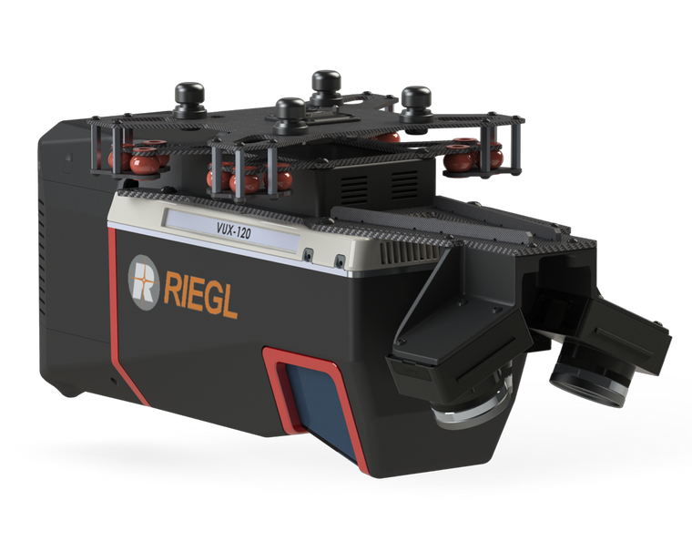
GeoCue Microdrones TrueView 720 3D Imaging LiDAR System with 3 Laser Channels + Imagery Collection
Learn More
TrueView 720 is our fourth generation RIEGL integration. This is the system for high point density corridor mapping. Using the RIEGL VUX-120 with 3 lidar scanners (oriented nadir and +10 degrees forward and -10 degrees backward) and 3 oblique/nadir cameras for extremely detailed data collection in one flight path. When scanning power lines, users will be able to capture the poles vertically, front and back.
Ask about custom camera configurations to cover your specific needs!
APPLICATIONS:
- Aerial Mapping / Surveying
- Construction
- Mining
- Volumetrics
- Precision Agriculture
- Digital Twins
- Defense


